For some of my English spoken friends I publish here a short version of my German report of my summer cycling tour this year. The pictures are the same as in the German version - sorry, that the comments are in German - so just enjoy the pictures.
Vuelta Verde: Cordillera Cantábrica/Pyrénées –
Mountains & Coastlines between Cabo Finisterre & Cap de CreusTotal: 34 days, 3701 km, 51.710 Hm
Average dates: 109 km/day, 14,5 km/h, 1.521 Hm/day
date, stage
distance (km), average velocity (km/h), climbing difference in altitude (Hm)
Part 1: PortugalTue, 17.6., Stuttgart |tuifly 9:10-10:50| Porto - Modivas - Praia Moreiró - Vilarhino - Trofa - (Sta. Tirso) – Braga
108 km, 17,2 km/h, 1.010 Hm
Sunny, but not really hot –
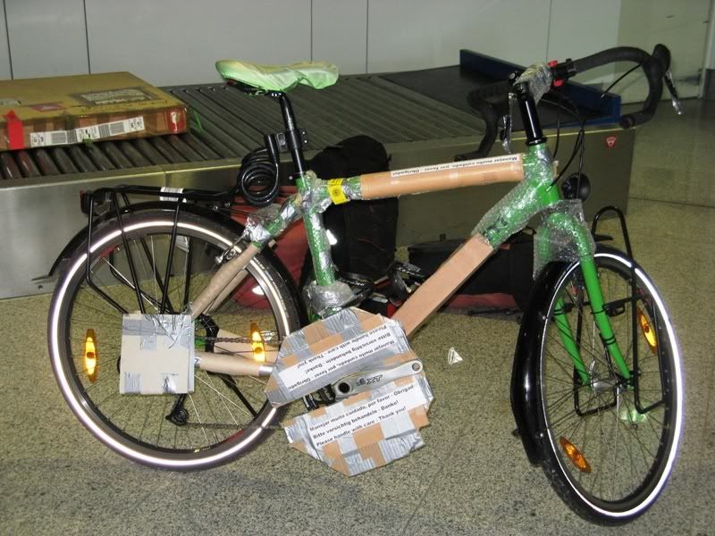
Flight without any trouble, bike in good condition – some problems with orientation, a lot of little roads with pavement, takes a lot of time, main roads in very good candition – wonderful beach at Moreiró, strange rocks and nice flowers, eucalyptus trees direction Trofa, easy up and down, a lot of traffic inside the country, some important historical buildings in Braga, beautiful garden area, broad streets, illumination because of festivity, just a few restaurants – awful night in the youth hostal because of drunken boy, just little sleep
Wed, 18.6., Braga - Gerês - Portela de Leonte (855m) - Portela de Homem (750m) - Quintas - Lamas de Mouro - Melgaco - Ponte Barxas
135 km, 14,7 km/h, 2.235 Hm
Sunny, but not really hot –
Different nice landscapes, impressing rocks, woods, flowers, hills, lake at the Rio Cávado with tourism, waterpark at Gêres, hard passes to climb with wonderful waterfalls, flowers, wood – open, dry areas inside part of Spain – sensational formations of rocks at borderline area Spain/Portugal, area of Lamas de Mouro, but hard to ride – wine and vegetables at the Rio Minho – wild camping
Please click at the photo for the gallery, click at the first photo in the gallery and go on by taking the cursor to the right of the photo and click for the next picture
 Part 2: Galicia
Thu, 19.6., Ponte Barxas - Cortegada - Ribadavia - Melon - (exc. Mezas/Rio Cerves) - A Caniza - Pto. d. Moncelos (800m) - Pontevedra - Portonovo
132 km, 15,4 km/h, 2.110 Hm
Sunny, sometimes cloudy, not really hot, later rainy –
Up and downs, dark rivers, wine area again – exciting waterfalls at Melón – hard ups and downs following, very different landscapes, wind mills, open hills, little waterfalls, shadowed woods and much more – cloudy and rainy at the coastline, a lot of traffic close to Pontevedra – camping place not very romantic, but okay
Fri, 20.6., Portonovo - San Vicente - Cambados - Isla de Arousa - Vilanova - Vilagarcía - 24 - Enfesta - (N 550) - Santiago de Compostela
126 km, 17,7 km/h, 1.005 Hm
First cloudy, late afternoon sunny weather –
Nice beaches, easy route at the coastline, after peninsula O Grove through vineyards, a lot of traffic – remote, very wonderful beach at Ilha Arousa – a lot of traffic to Santiago, a lot of easy ups and downs, much restaurants, scenic night life in Santiago, living atmosphere – camping in good position at a hill
Sat, 21.6., Santiago de Compostela - Noia - Muros - Cée - Fisterra - Cabo Fisterra - Fisterra (~)
140 km, 18,2 km/h, 1.395 Hm
Sunny parts in the morning, even hot, later cloudy, getting much colder in the evening –
Even for non-religous people impressing cathedral in Santiago, pilgrims all over – even with bikes, good tasting bread and cakes – hard ride back to the coastline, again many ups and downs, different impressions from the sea, Cabo Fisterra in dusty clouds – all over party fire at the beaches because of midsummer day – wild camping
Sun, 22.6., Fisterra (~) - Cée - Molinos - Ponte do Porto - Laxe - Malpica - Noicela - Arteixo
119 km, 14,9 km/h, 1.710 Hm
Dusty and rainy until afternoon, more sunny later on –
A lot of pilgrims on foot and by bike to see in the morning, idyllic places inside country from Cée to Molinos, many ups and downs, most of them strong to ride, eucalyptus wood close to the coast, open cow willows, steep down to Noicela, heavy ups and downs at the coast – romantic sun setting at the camping direct at the sea
Mon, 23.6., Arteixo - La Coruna - Sta. Cruz - Sada - Perbes - Pontedeume - Ferrol - Castro - Meiras - Valdovino
113 km, 14,7 km/h, 1.230 Hm
Cloudy in the morning, later hot & sunny, cloudy in the evening –
Industrial zone to La Coruna, much traffic, nice boulevard around the town with beaches, a lot of little and big monuments to look at, museums possible but not done –some nice beaches at Perbes, some ups and downs, old bridge & tower at Pontedeume, elegant shopping streets in Ferrol – charming camping place in Valdovino close to dune beaches
Tue, 24.6., Valdovino - Cedeira - Ortigueira - Porto do Bargueiro - Viveiro - Foz
125 km, 16,7 km/h, 1.640 Hm
Cloudy and cold in the morning, sunny & hot in the afternoon, cloudy in the evening –
Mystical view on ria with bridge, stylish rocks in the sea at Ortigueira, wonderful beach at Porto do Bargueiro, impressing cycling bridge, lively centre in Viveiro, many tourists, old bridge, interesting houses – camping not important, but close to the sea
Wed, 25.6., Foz - San Cosme - Praia St. Cathedrais - Ribadeo - Pto. Marco de Alvare (575m) - Lugo
128 km, 16,6 km/h, 1.330 Hm
Terrible rainy day, some dry interludes, but dark clouds all over –
Worth to sea all the beaches east of Foz, bizarre sea rocks, sensational bowed rocks at the Praia de Cathedrais, carry on low tide for visiting – beautiful buildings in Ribadeo, some hard climb to the pass with gorge, later on smoothed hills, boring landscape, multiple easy ups and downs, ancient town wall in Lugo, big cathedral – staying in a hostal (no camping there)
Thu, 26.6., Lugo - Sarria - Samos - Pto. El Poyo (1337m) - Seoane do Courel - Alto do Boi (1061m) - Quiroga – Vlaster?/Montefurado?
138 km, 13,8 km/h, 2.260 Hm
Starting cloudy, sunny & hot in the afternoon –
Traffic explosion to Sarria, then getting less, a lot of storks to see, to Puerto El Poyo a lot of pilgrims in opposite direction, huge monastery in Samos, yellow broom more and more, small road through the Sierra de Courel, fanstastic wood and waterfalls, old beeches and oaks, heavy offroad way to Alto do Boi because of road plot, remote scenary at Rio Sil instead of main road and railway in the small valley – wild camping
Fri, 27.6., Vlaster/Montefurado - (A Rua) - Freixido - Alto de Covelo (1052m) - Viana do Bolo - Alto do Canizo (1085m) - Portilla de la Canda (1262m) - Padernolo (~1350m) - Puebla de Sanabria
119 km, 15,2 km/h, 2.005 Hm
Sunny & hot –
Steep climb through vineyards, open landscape most of the day, lake and red rocks at Viana do Bolo, wind mills on the plateau at Alto Canizo, highway, railway, some old trees later, waterfalls, small road, then again broad road, plateau and open landscape – popular camping place, not really quiet
Please click at the photo for the gallery, click at the first photo in the gallery and go on by taking the cursor to the right of the photo and click for the next picture
 Part 3: Castilla y Leon (Nordwest)
– Sierra de la Cabrera, Sierra del Teleno, Montes Aquilianos, Reserva Nacional del los Ancares Leoneses, Reserva Nacional de Degana (Asturias), up to VillasecaSat, 28.6., Puebla de Sanabria - Puente de Sanabria - Alto del Penon (1840m) - Truchas - Alto Las Portillinas (1950m) - Alto El Morrodero (1760m) - Ponferrada
108 km, 13,1 km/h, 1.990 Hm
Hot & sunny day –
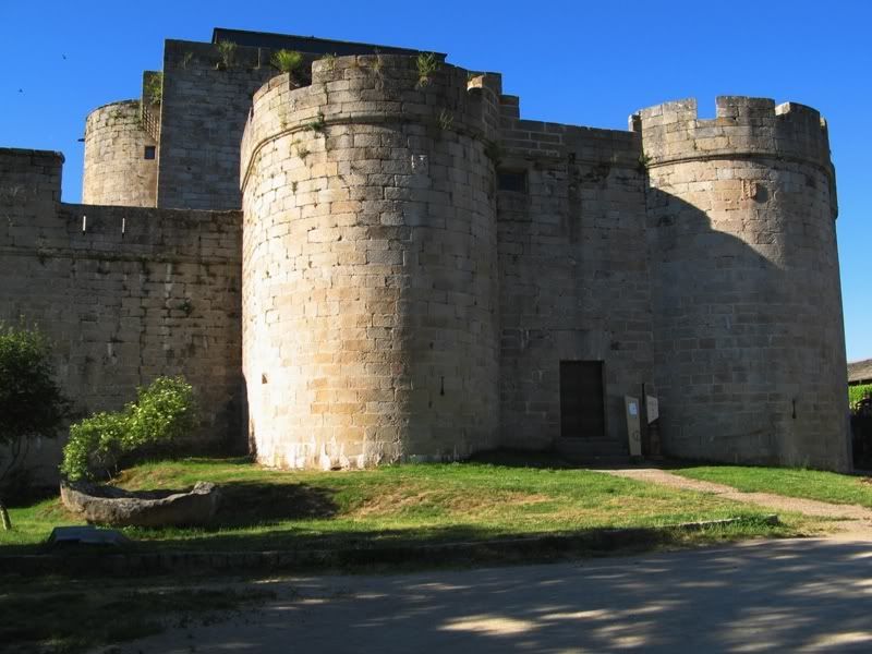
Charming town Puebla de Sanabria with castle, some green hills, then scarce plateau und mountains, flowers, steep climb to Alto del Penon, little trees, green areas, water down the other side, remote villages, green meadows with river, yellow broom to Alto Las Portillinas, steep climb, open, far on scarce vegetation, wind mills, far view, long way down to Ponferrada – busied town, tourists, pilgrims, young and old, every kind, night life, remarkable castle, ancient town buildings – wild camping
Sun, 29.6., Ponferrada - Carucedo - Las Médulas - Carucedo - La Barosa - Cacabelos - Candin - Pereda de Ancares
104 km, 12,4 km/h, 1.640 Hm
Cloudy with sunny intervals, sweltering climate –
Exciting red rocks, result of Roman mining for gold, now wonder of nature, steep climb to the plateau view – some more hard climbs, plateau at Cacebelos, valley with river, gorge, meadowed hills, remote villages – terrible offroad way to Candin because of road plot – remote camping place in the mountains – soccer European championship final: Germany looses, Spain wins
Mon, 30.6., Pereda de Ancares - Candin - Pto. d. Cientuegos (1686m) - Pto. d. Cienfuegos (1686m) - Campa de Tormaleo (1037m) - Llanda - Sisterna - Alto del Campillo (1078m) - Degana - Pto. d. Cerredo (1359m) - Villablino - Villaseca
84 km, 10,8 km/h, 1.775 Hm
Sunny & hot –
End of the road close to the beginning – cattle way upward, some parts not possible to ride, many different flowers, small waterfalls, later on more stony, but still flowers, cattle meadows, very very hard because of the offroad character, second pass same way, but less vegetation, a little bit better to ride, very steep way down to the road at Tormaleo, coal mining – large gorge, ups and downs, different landscapes – staying in a hostal
Please click at the photo for the gallery, click at the first photo in the gallery and go on by taking the cursor to the right of the photo and click for the next picture
 Part 4: Asturias, Cantabria I, Castilla y León
– Reserva Nacional de Somieda, Parque Nacional de los Picos de Europa, up to Playa OyambreTue, 1.7., Villaseca - Piedrafita - Pto. d. Somiedo (1486m) - Pola de Somiedo - Alto de la Farrapona (1708m) - Pto. Ventana (1587m) - La Plaza - Caranga - Alto de la Cobertoria (1173m) - Pola de la Lena - Ujo
135 km, 13,5 km/h, 2.620 Hm
Cold & sunny intervals in the morning, getting more and more cloudy, cold, rainy in the evening, hard rain in the night –
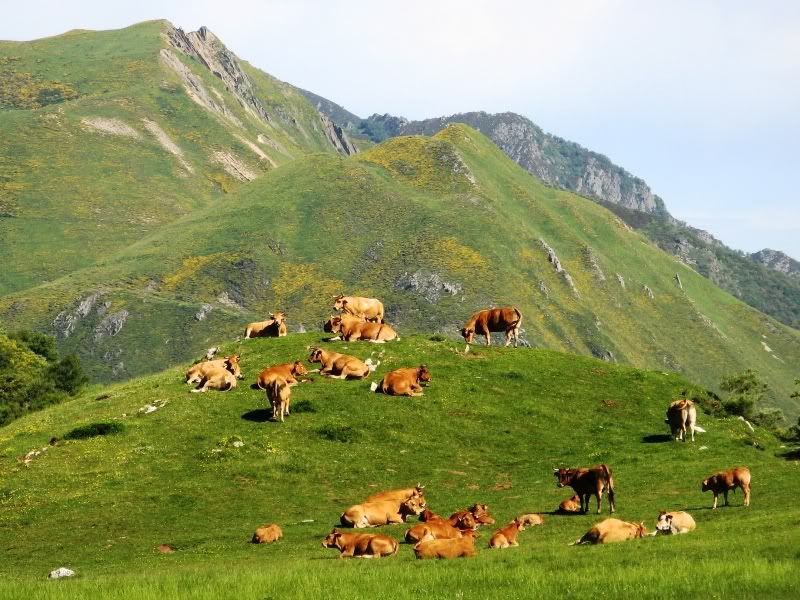
Open plateau with far view to mountains around, cows and sheeps, from Somiedo pass down into a gorge, far more gorge first part to Alto de la Farrapona, exciting rocks, wonderful flowers, typical cabanas (traditional huts), open mountains area on the top – offroad down from Farrapona, open landscape, a lot of yellow broom, wind in front of me up to Ventana pass – two gorges down, remarkable stones, holes to visit – very hard climb to Cobertoria pass, riding in the cloud and in the night, road plot again down the pass – terrible night, no small hostal to find, no camping place of course, wild camping late night without taking the tent, then hard rain starting in the deep night, fleeing to a veranda of a house, no sleep this night
Wed, 2.7., Ujo - Cabanaquinta - Pto. d. San Isidro/Pto. Brana (1520m) - Cofinal - Pto. de Las Senales (1625m) - Pto. d. Tarna (1490m) - CL635/N625 - Pto. d. Panderruedas (1450m) - Posada de Valdeón
126 km, 13,3 km/h, 2.170 Hm
Cloudy, windy, cold, later very cold, very windy, rainy –
Long smooth climb, later little steeper to San Isidro pass, open cattle meadows, south some brooms, cabanas, lake – at Cofinal plateau, further on exciting pass, not so hard, but lot of flowers, different kind of woods, waterfalls – next passage down open landscape, not interesting, lake, meadows, cows and sheeps – last part to the Panderruedas pass different, with water floated meadows, little woods, mountain panorama to the north, but not to see because of clouds and rain – staying in a hostal
Thu, 3.7., Posada de Valdeón - Pto. d. Pandetrave (1562m) - Pto. d. Glorio (1609m) - La Vega - Potes - Panes - Las Arenas
110 km, 16,6 km/h, 1.100 Hm
Sunny day, but not to hot, second part windy –
Great view to the mountains, exciting panorama whole way to Pandetrave pass, like Dolomites in the Alps, mountain meadows with colourful flowers – green small woods, yellow broom, river valley southside – remarkable gorge with nearly dark stones to Porto de Glorio, yellow brooms between – long ride down from the pass, great panorama view, red roofs of the villages, generous feeling – Potes touristic town, a lot of nice houses, old buildings, good atmosphere, a lot of local products like cheese, liqueur, chocolate etc. – large gorge Hermida, impressing small stone walls, fast ride – easy road to Las Arenas, gorge again, getting more and more exciting, old and small bridges – good camping, possibility for canoeing etc.
Fri, 4.7., Las Arenas - Poncebos/Cares-Schlucht - Las Arenas - AS115/AS114 - Alto de las Estazadas (?m) - Alto de Ortiguera (?m) - Llanes - Playa la Ballota - Colombres - San Vicente - Playa Oyambre
105 km, 15,1 km/h, 1.070 Hm
Sunny & hot day, some cloudy in the evening –
Excursion to the gorge of Cares, further to the last point for cycling, pathway upwards, a way aside the river is closed by rockfall – be back on the main road wonderful view to the Naranjo de Bulnes, most impressing mountain of the Picos de Europa – charming house fronts, ancient buildings and castle, small harbour, lively atmosphere at the cidrerias in Llanes – wonderful beach Playa de Ballota, steep offroad way to the beach – easy way, but partially heavy traffic to San Vicente: ancient buildings, fish restaurants, old bridge, wonderful view from above, good atmosphere – short hard climb next – big camping at Playa Oyambre, little sun setting
Please click at the photo for the gallery, click at the first photo in the gallery and go on by taking the cursor to the right of the photo and click for the next picture
 Part 5: Cantabria II
Sat, 5.7., Playa Oyambre - Rioturbio - Ruisenada - Comillas - Cabezon - Sopena - Pto. d. Palombera (1260m) - Reinosa
82 km, 11,9 km/h, 1.460 Hm
Little rain, heavy rain, cold, windy, more rain, cold and cloudy in the evening, terrible weather –
Remote natural park close behind the coast, lost time because riding wrong way, buy a new stand for my bike in Cabezon (old one has broken), easy ride to Cabezon, market in Cabezon, some breaks because of the rain, riding through a big cloud, wonderful Palombera pass (~ 6 °C) with exciting waterfalls, old trees, a huge beech wood – south open lanscape, plateau – staying in a hotel in Reinosa (~ 10 °C)
Sun, 6.7., Reinosa - Corconte - Pto. del Escudo (1011m) - Vargas - Barcenilla - Playa de Valdearenas - Liencres - Cabo Mayor (Santander)
110 km, 17,1 km/h, 735 Hm
Cold, cloudy whole day, windy, getting warmer in the evening at Santander –
Huge lake of the Ebro, some idyllic impressions with horses and cows, but not exciting – wind mills at the pass, villages, woods, meadows down, typical coastal landscape to the sea, dune beach, special flora at Liencres, mild climate at Santander, nice promenade, lighthouse – good camping close to the lighthouse
Mon, 7.7., Cabo Mayor - Santander - Villanueva - Parque de la Naturaleza de Cabárcena - Carbárceno - San Roque de Riomiera - Portillo de Lunada (1350m) - Las Nieves - Espinosa
104 km, 11,7 km/h, 1.840 Hm
Sunny & hot in the coastal area, cold & cloudy in the mountains, some rain at the pass –
Wonderful sea promenade in Santander, nice beaches, wonderful castle, colourful parks, remarkable house frontiers, town of the poets, worth to spend some time there – exciting excursion throug the natural parc with foreign animals (tigers, gorillas, bisons, lions, elephants, antelopes etc.), but 18 € entrance fee, steep roads inside (cars allowed, too), crazy stone formations, most in red (from iron), worth to cycle through it – with first rocks of the gorge the clouds coming back, hard climb to Lunada pass, open willows, sheeps and cows, some strange rocks, pass in the cloud, open cultural landscape with stonewalls south – staying in a casa rural with good breakfast
Tue, 8.7., Espinosa - Portillo de la Sia (1240m) - Pto. del Asón (682m) - Arredondo - Ramales - Laredo - Castro-Urdiales - Pobena
115 km, 15,0 km/h, 1.290 Hm
Cold in the morning, some clouds, more and more sunny, getting hot –
Market in Espinosa, same landscape upwards like day before, some fern between the willows, wind mills on top, small, view to a plateau with many villages, small but impressing waterfall as source of the Asón river, small road, wonderful wood and mountain walls – nice houses in Ampuero and Limpias, large beach at Laredo, many ups and downs following – impressing buildings in Castro-Urdiales, cathedral, lighthouse, bridge, market hall, view to the sea – again ups and downs, heavy traffic on the highway aside – in Pobena no camping, but pilgrim hostal, there staying in my tent
Please click at the photo for the gallery, click at the first photo in the gallery and go on by taking the cursor to the right of the photo and click for the next picture
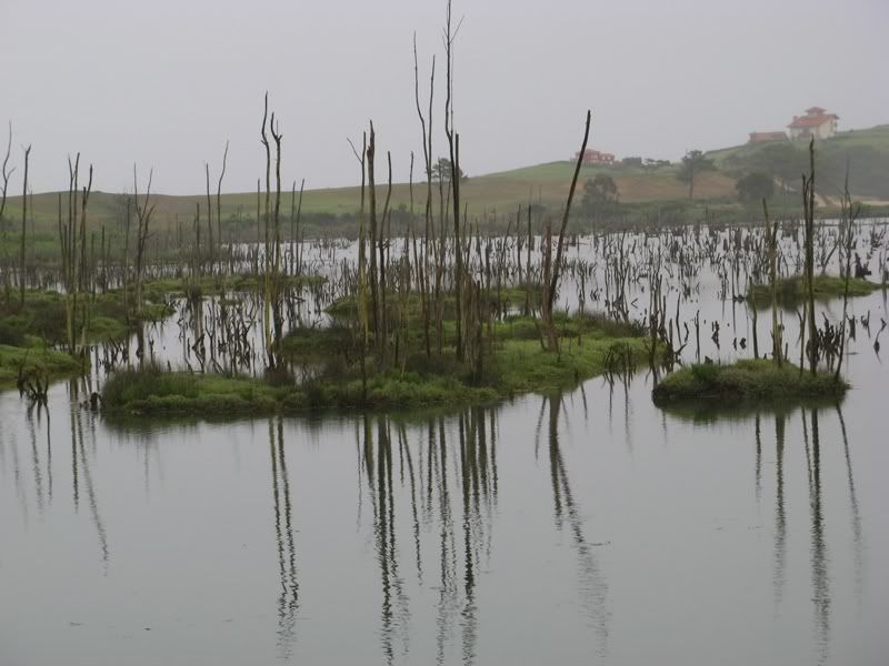 Part 6: Euskal Herria (Spanish/French Basque Country, Pyrenées I)
Wed, 9.7., Pobena - Santurzi - Portugalete - Bilbao - Asua - Derio - Mungia - Fruiz - Gernika-Lumo - Alto Autzagana (230m) - Durango - Manaria (~)
116 km, 14,2 km/h, 1.190 Hm
Sunny & hot, cold night –
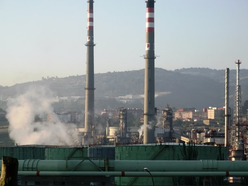
Passing industrial area, no way at the coastline possible (harbour area closed for crossing), over a hill to Portugalete, world famous bridge Puente de Colgante, nice houses, fish harbour – terrible traffic to Bilbao, broad streets there, Guggenheim Museum with fascinating building, even more avantgarde design in Bilbao, some relaxing places in parcs or the river – horrible way out of the town for cyclists (northeast), tunnels, traffic explosion – ups and downs the road to Mungia, open landscape, remote woods to Gernika-Lumo, many Basque racing cyclists, heavy traffic again to Durango – too late for the Urkiola pass, wild camping
Thu, 10.7., Manaria - Pto. d. Urkiola (713m) - Landa - Gordoa - Etxarri-Aranatz
81 km, 16,0 km/h, 675 Hm
Sunny & hot, but some cold wind between –
Headache, some sickness in the morning, still remaining the whole day – hard climb to Urkiola, nice villages with typical Basque architecture, many labels for Basque independancy, break at a lake, open landscape, not very attractive, straight road, Urbasa mountains with rocks like an organ at the horizon – nice camping with old oak trees
Fri, 11.7., Etxarri-Aranatz - Irurtzun - Lekunberri - Alto de Uitzi (799m) - Leitza - Pto. d. Usateguieta (695m) - Doneztebe - Irurita - Arizkun - Pto. Izpegui (672m) - St. Etienne-de-Baigorry - St. Jean Pied-de-Port
134 km, 14,8 km/h, 1.540 Hm
Cloudy, cold, windy, later very rainy –
First easy way, from Irutzun little gorge, short hard climb, beautiful houses in Lekunberri, Leitza, Doneztebe, Arizkun – landscape changing to smoothed green hills, wonderful Izpegui pass with old trees, slope curves, small road – all mountains in clouds – camping close the ancient town wall – first time serious coughing
Sat, 12.7., St. Jean Pied-de-Port - C. d'Haltza (782m) - C. d. Burdincurutcheta (1135m) - Iraty (Lac)
28 km, 8,0 km/h, 935 Hm
Heavy rain in the night, in the morning, thunderstorm, cold, waiting for hours, little rain at noon, in the mountains again hard rain, heavy wind, very cold, breaking off of the stage –
Marvellous Basque framework houses in St. Jean Pied-de-Port, good local products, a lot of pilgrims – all mountains drunken in clouds, very hard climb, more and more rainy, break at a bistro at a lake, but no further ride possible – staying in a hut for walkers, but a drunken man there staying, talking, drinking and smoking through the whole night, no sleep possible, horrible night
Please click at the photo for the gallery, click at the first photo in the gallery and go on by taking the cursor to the right of the photo and click for the next picture
 Part 7: Pyrenées II (with Costa Brava)
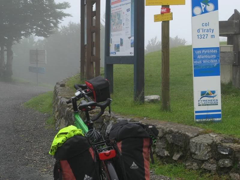
Sun, 13.7., Iraty (Lac) - C. Bagargui/C. de Iraty (1327m) - Larrau - Montory - Arette - St. Christau - Louvie-Juzon - Asson - Lourdes
127 km, 15,3 km/h, 1.375 Hm
Cloudy, very cold (3 °C) in the morning, some sunny intervals, but mainly cloudy until evening, some rain, always cold –
Enjoying beech wood upwards, a lot of sheeps in the mountains, small road down from Iraty pass, dense wood, gorge after Larrau, open willows with mountains at the horizon at Montory to Arette, easy ups and downs, huge green lighting wood Bois du Bager, open willows, some castles, river scenery at the Gave de Pau – quiet camping a little bit outside from Lourdes
Mon, 14.7., Lourdes - Argelès-Gazost - Soulom - Vallée de Cauterets - Soulom - Luz-St. Sauveur - Barèges
55 km, 13,8 km/h, 1.030 Hm
Sunny, but not hot, windy –
Flat cycling road to Argelès-Gazost, inflationary Tour-de-France tourism, cyclist all over, Gorge de Luz closed for the TdF, riding a little bit in the the valley of Cauterets, wonderful waterfalls, green flora, exciting road, easy to ride upwards – looking the last part of the tour racers, good ride through the Gorge de Luz, hard climb from Luz-St.Saveur to Barèges, get known of a Basque cycling tourist from Pamplona called Txibi, good conversation – caughing is getting worse – camping direct at a mountain river
Tue, 15.7., Barèges - C. du Tourmalet (2115m) - St. Marie-de-Campan - Bagnères-de-Bigorre - Mauvezin - Anères - Montréjeau - St. Gaudens
102 km, 14,8 km/h, 1.520 Hm
Sunny & hot –
Climbing the Tourmalet together with Txibi – Txibi has to fight against a tire-trouble, myself against a very agressive coughing – many cyclists on the road and at the pass, even motor tourists, too – mostly open mountain scenery, some waterfalls downward, Txibi is taking different way from St. Marie-de-Campan – open willows, a lot of symbols for the TdF at the houses, nice houses in Bagnères, parc with big trees – again open landscape, up and down, panoramic views, some glissade through refreshing wood, medieval castle at Mauvezin, St. Gaudens on a little hill, not important – camping with panoramic view to the Pyrénées
Wed, 16.7., St. Gaudens - Encausse-les-Thermes - Col de Buret (599m) - C. d. Portet d'Aspet (1069m) - Augirein - St. Girons - Massat - C. de Four (?m) - C. des Caougnous (947m) - C. de Port (1250m) - Saurat
121 km, 14,1 km/h, 1.750 Hm
Sunny & hot until afternoon, later getting very cloudy and even cold –
Idyllic way around Encausse-les-Thermes, some people around waiting for the TdF, dense wood, small street, exciting route, very hard climb to the Col de Portet d’Aspet, in the east road close to the river, idyllic places, nice villages, later open willows, some strange rocks – special ceramic works by an artist (Jean-Marie Mathon, Atelier le Pyrénoust, Moulis), little sculptures of fungus, of workers of the mountains and even caricaturs from famous cyclists, worth to visit – nice town of St. Girons at the water – Gorges de Ribaouto more interesting in the second part, real climb starting to Col de Port at Massat, smooth gradient, but still hard coughing – nice camping place outside the village
Thu, 17.7., Saurat - Tarascon-s-Ariège - Grotte de Niaux - Ax-les-Thermes - Port de Pailhères (2001m) - la Pla
81 km, 11,5 km/h, 1.830 Hm
Cloudy, rainy, cold, windy, very cold at the Col de Pailhères –
Nice position of Tarascon at the river, tower on a hill, get tablets in a pharmacy – short, but hard climb the Niaux cave, too long to wait for entrance, so going back, visiting Pyrénées museum in Niaux down under – a lot of rocks with holes from earlier times to see, heavy traffic until Ax-les-Thermes, warm foot bathing there – hard climb to the Col de Pailhères, flowers, cascades, wonderful nature, but too cloudy to see a lot, hard wind on the top, strong caughing, exciting slope curves downward, quiet landscape – camping good for recovering, if not rainy
Fri, 18.7., La Pla - Quérigut - C. d. Moulis (1099m) - C. d. Garavel (1256m) - C. d. Jau (1506m) - Prades - Finestret - Baillastavy
89 km, 13,4 km/h, 1.555 Hm
Sunny & hot –
Castle in Querigut, bright light with blue sky, steep downward to the Aude, at once turning upwards, open cattle willows, flowers, panoramic view even back to the mountains around the Pailhères pass – great nature at the Col de Jau, different kind of woods, flowers, cascades, strange old trees, cattle willow at the top, view to the Canigou, more open to the east, towers of the Katharer people, small villages, gorge, exciting road close to the rocks, tremendous glissade feeling – market at Prades, nice to stay there – vinery around, peach plantations allover, typical villages of Katherer country, gorge upward (smooth gradient), rustical supper – wild camping
Sat, 19.7., Baillastavy - C. Palomère (1036m) - C. d. l. Cescargue (1393m) - Arles-s-Tech - St. Laurent-de-Cerdans - Tapis - Darnius - Figueras
103 km, 14,1 km/h, 1.455 Hm
Hot & sunny –
Gorge far on, hard climb, offroad way after the Palomère pass, highest at the tower in open mountain landscape, view to Canigou, wonderful flowers around – asphalt back at the Col de la Descargue, long glissade, a lot of wood with refreshing small waterfalls and rivers – very hot at Arles-s-Tech, some nice buidlings – road to Laurent-de-Cerdans with smooth gradient, little hard climb after – at the borderline to Spain changing landscape, red mountains, pine trees, no shadow, panoramic views, up and down, of course mostly downward – heavy traffic at the N II, plain area, boring landscape, only broken by the town Figueres – camping at the main road, not convincing, but good taste in the restaurant
Sun, 20.7., Figueres - (Roses) - Cadaques - Cap Creus - Cadaques - Selva de Mar - Portbou - Coll de Belitres (165m) - Cerbère |NZ 20:20-8:34| Strasbourg |TGV 9:45-11:03| Stuttgart
98 km, 15,7 km/h, 1.235 Hm
Cloudy & hot, later sunny & hot –
Visiting the Dalí museum at Figueras, great genius artistry – flat straight road to Roses, much traffic – cable of back brake broken, only one brake further on – smooth climb though open landscape with olive trees, smooth glissade down to Cadaques, a lot of tourists, instead a nice place with beach and fishing harbour – up and down to the Cap Creus, short hard climbs, great feeling at the cape – fast ride back to the top, smooth glissade to Selva de Mar, ups and downs with a lot of blue of the sea aside – no serious climbs anymore – finishing in Cerbère with wine-test, a refreshing shower, a good supper with fish – night train back to Strasbourg and TGV to Stuttgart without any important troubles
Please click at the photo for the gallery, click at the first photo in the gallery and go on by taking the cursor to the right of the photo and click for the next picture
